|
||
|
|
Welcome to Ål 52 - favorite hikes in Ål
You are just a click away from known and unknown hikes, long or short, easy or challenging, for young or old. You can also print the maps and descriptions and bring them with you. If you prefer a more detailed map, we recommend you to buy the maps referred to in the tour descriptions. For some hikes in the high mountains it is recommended to have a proper map and not just the printed pdf. Hiking maps and free maps of the centre of Ål are available at the book store and Ål tourist information.
Ål52 is a cooperation between Ål municipality and Ål Utvikling AS (the destination company). The webpage is being updated and edited continously, and new hikes are being added. Should you find any mistake or something missing, do not hesitate to contact us at Ål tourist information: Phone +47 32 08 10 60 or post@alturistinfo.no 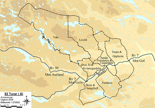
|
|
| Design på norsk: Utforming.no / Publisert med WideCMS | ||
